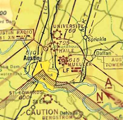
i came across this image of an early 1940's era map showing Mueller Airport here in Austin, TX.
i came across this image of an early 1940's era map showing Mueller Airport here in Austin, TX. What i thought was interesting is the striking similarities of the circular plots on this map and what Portals look like via the Intel Map. Are these standardized map icons?
http://www.airfields-freeman.com/TX/AustinMueller_43JulSect.jpg
http://www.airfields-freeman.com/TX/AustinMueller_43JulSect.jpg
Comments
Post a Comment